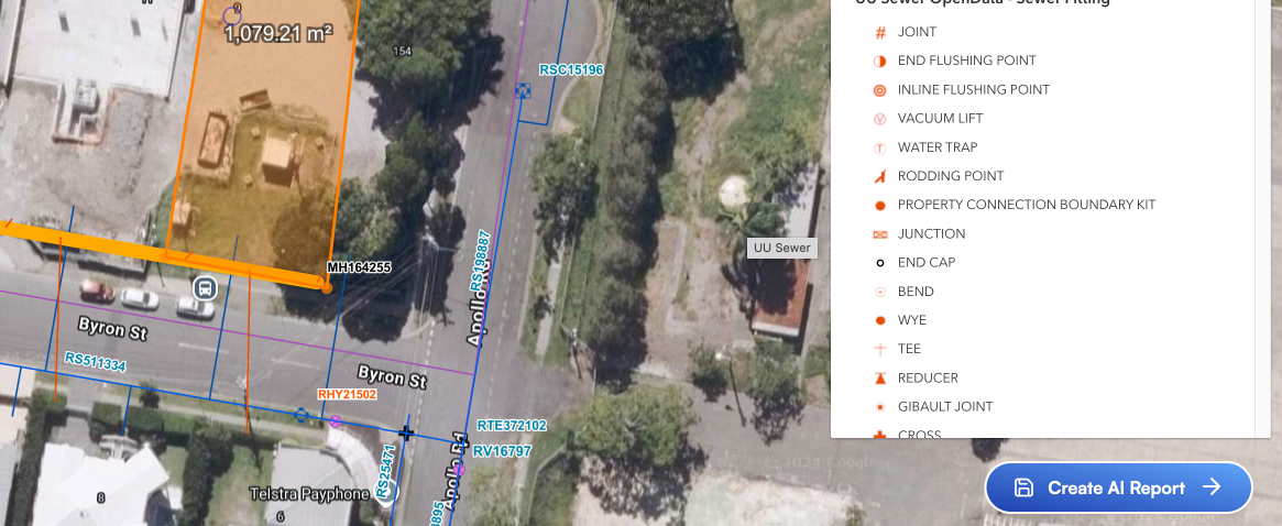
State-of-the-Art Google Vertex AI
processes GIS imagery using plain English instructions to build your report - for example: “Identify if the diameter of water services within 10m of the property boundary is sufficient for ABCD”. This is a huge time-saver!